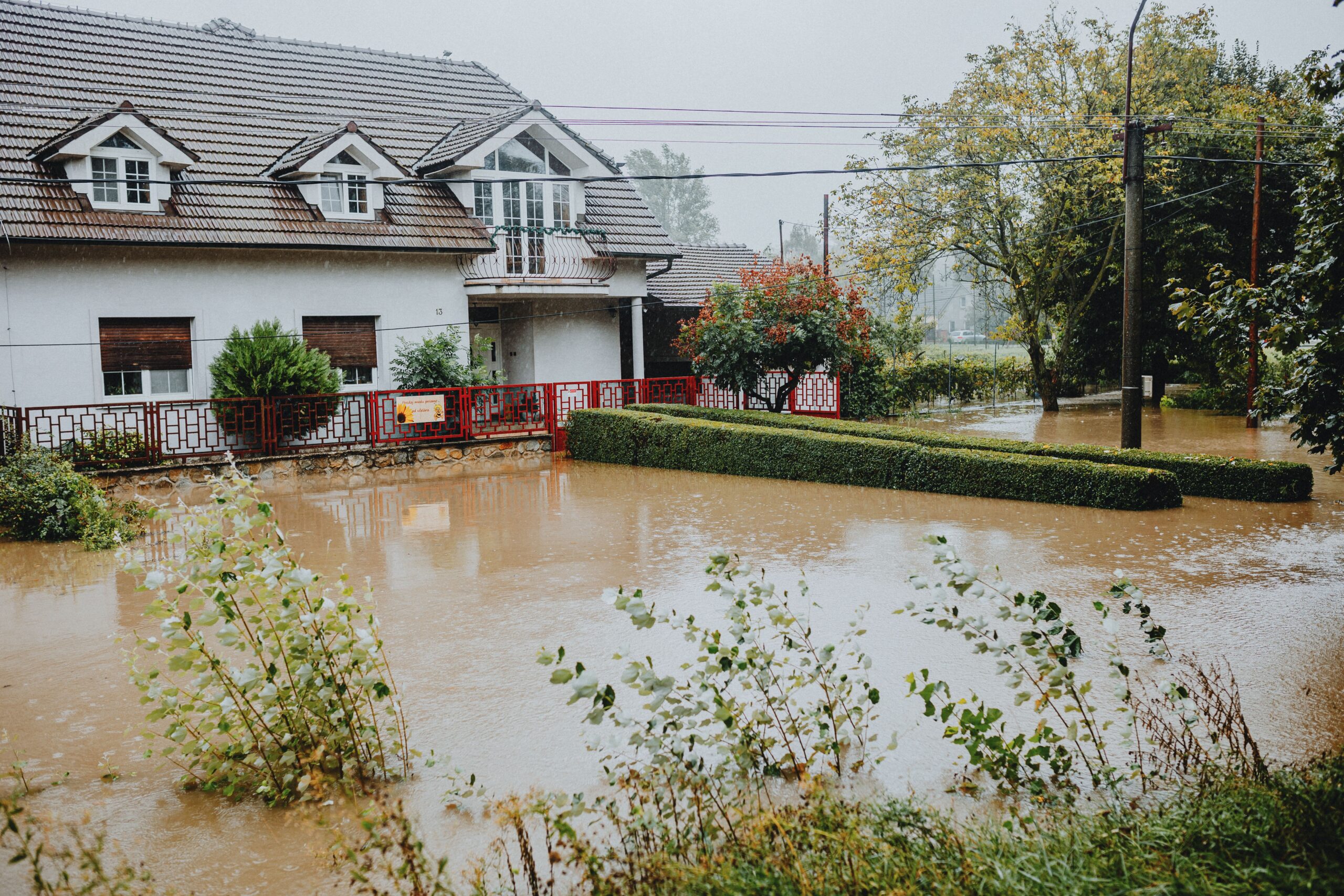

Florida homeowners struggle with standard insurance coverage during severe seasonal storms. Underwriters previously relied on broad regional maps missing precise property heights. Adopting real-time property risk monitoring completely transforms how carriers price policies. Families partner with Flood Insurance HQ to secure fair coverage rates. This support helps residents avoid massive rate jumps during weather emergencies.
How Property Risk Monitoring Transforms Florida Home Insurance
Satellite feeds and live tracking supply exact elevation and drainage data. Underwriters apply real-time property risk monitoring to track environmental hazards. This modern method replaces outdated regional maps with true property conditions. Carriers price policies fairly instead of relying on broad regional estimates.
Live environmental data transforms modern coverage decisions for coastal property owners. Regional homes face growing environmental threats during active storm seasons. Homeowners learn how to secure precise rates through careful property evaluations. Utilizing innovative property risk monitoring technology, this guide breaks down advanced assessment tools for users. This guide answers key policy questions regarding severe weather shifts. Flood Insurance HQ helps Florida residents protect their long-term property investments.
Why Are Florida Properties Becoming Increasingly Vulnerable?
Coastal spots and inland areas face constant flooding from heavy rains. Rising tides during peak storm months worsen regional flood risks. Older underwriting setups use past loss figures, ignoring current climate shifts. Struggling neighborhood drainage systems make local property protection much harder. Insurance companies judge regional risk using broad maps, skipping lot elevations. Homeowners watch yearly bills climb because of these generalized evaluations. Active tracking replaces old records, leaving households open to unexpected expenses. Modern realities demand sharp tracking tools to stop serious property damage. Unexpected weather hits the region during vulnerable seasonal weather cycles. Securing a dependable property insurance quote becomes essential for every Florida homeowner.
Want to take control of your property’s safety before the next storm hits?
How Do Insurers Analyze Real-Time Flood Risk Data?
Advanced digital metrics help underwriters move past broad regional maps toward precise property reviews across Florida neighborhoods.
- Replacing Broad Regional Maps
Live metrics help insurers move past broad regional maps toward exact property reviews. Standard flood maps group streets into single risk brackets, missing vital elevation differences across individual neighborhoods.
- Targeting Single Lot Evaluations
Access to real-time flood risk data permits targeted evaluation of single lots through Flood Insurance HQ. This specific assessment gives homeowners a clear view that cuts underwriting guesswork and shows precise exposure levels.
- Preventing Unfair Rate Hikes
Evaluating precise water flow patterns prevents unfair rate hikes across the state. Accurate environmental measurements ensure that properties receive fair coverage terms matching actual geographic vulnerabilities.
- Tracking Live Environmental Shifts
Continuous monitoring captures sudden changes in local weather patterns and ground moisture levels. Insurers utilize these instant updates to evaluate current threats without depending on outdated historical records.
- Assessing Drainage Performance
Detailed moisture sensors and mapping feeds measure how quickly neighborhoods shed heavy rainfall. Reviewing local drainage efficiency allows carriers to determine exact vulnerability levels for individual residential structures.
How Does Better Property Risk Intelligence Work?
Advanced digital tools help us turn basic coverage into active safety steps across your Florida community.
- Building Proactive Mitigation Habits
Live data feeds change underwriting by focusing on safety across coastal and inland zones. Instead of waiting for storms to pass, we help you use current insights to protect vulnerable areas early.
- Receiving Proactive Mitigation Alerts
Automated alerts warn residents about rising water or blocked drainage near buildings. These quick messages let your family set up protective barriers before weather turns severe.
- Guiding Targeted Home Improvements
Detailed reports highlight specific weak spots across residential properties. This clear direction helps you install sump pumps or raise electrical panels to safeguard valuable assets.
- Adjusting Dynamic Premiums
Proven risk reduction steps verified over time reward regular upkeep with steady coverage costs. At Flood Insurance HQ, we help you use these updates to secure fair and customized pricing options.

How to Secure A Reliable Property Insurance Quote?
Securing a proper policy demands expert advice to match broad protection with household budgets. Finding a reliable property insurance quote involves evaluating key elements for clear terms.
- Weighing Private and Government Options
Comparing private plans against government programs helps you find proper deductibles and limits. This review ensures chosen policies match your personal financial limits and local risk exposure.
- Partnering With Experienced Advisors
Working with experienced advisors streamlines paperwork so foundation types appear correctly on forms. Professional help removes administrative errors and ensures underwriting teams recognize structural changes.
- Providing Accurate Structural Details
Homeowners must share correct facts to receive precise pricing estimates without facing administrative delays. Clear paperwork regarding building materials guarantees transparent premium calculations across participating providers.
- Evaluating Mitigation Upgrades
Documenting property additions like storm shutters and reinforced roofs influences final pricing calculations. Underwriters review these resilience measures to offer lower deductible rates for residential buildings.
Ready to see how live environmental tracking can lower your annual insurance costs?
Finalizing Your Property Protection With Flood Insurance HQ
Adjusting to shifting environmental patterns helps keep homes safe against unpredictable weather throughout the state. Getting a dependable quote for flood insurance through Flood Insurance HQ lets families compare tailored plans with total clarity. Contact our specialists today to check policy choices and secure your property against upcoming water damage. Expert support guarantees residential structures receive proper safety measures aligned with local regional environments. Partnering with a knowledgeable agency makes obtaining reliable household coverage easier.
Frequently Asked Questions
-
What does continuous environmental tracking mean for my annual premium?
Live tracking evaluates homes using current weather metrics instead of old historical maps. This exactness establishes fairer rates matching actual elevation and flood defenses. Adopting real-time property risk monitoring cuts through guesswork to establish precise pricing for every household. Property owners experience fairer financial terms because carriers analyze exact geographic conditions rather than relying on generalized regional estimates.
-
How do digital policy updates change standard coverage choices?
Navigating digital updates requires reviewing platform dashboards and examining policy documents directly. Accessing clear digital portals simplifies understanding new requirements without complications. Utilizing property risk monitoring technology streamlines reviewing modern insurance adjustments. Consumers gain clearer insight into evolving policy terms by tracking environmental updates directly through accessible online carrier portals.
-
Why is accurate environmental data vital for coastal homeowners?
Precise data stops properties from landing in broad risk groups that raise costs. Exact numbers display a home’s true elevation and drainage to secure fair pricing. Leveraging real-time flood risk data ensures underwriters evaluate actual geographic exposure correctly. Coastal residents avoid unfair penalty charges by providing specific lot elevations and localized storm defenses to insurance carriers.
-
What steps improve my chances of receiving a quote for flood insurance?
Keeping clear records of foundations, installing dependable sump pumps, and raising utilities boosts applications. Showing these protective items proves lower risk to underwriters. Securing a competitive property insurance quote depends entirely on documenting vital structural improvements. Homeowners demonstrate proactive property maintenance by submitting verified inspection reports directly to insurance providers.
-
How quickly do modern assessment tools update my property profile?
Digital platforms read satellite feeds and local sensors constantly to match current weather shifts. Underwriters view live updates instantly to keep policy terms correct. Applying property risk intelligence accelerates profile updates across modern insurance systems. Automated networks eliminate manual reporting delays by syncing live environmental tracking metrics directly into active policy databases.