

FEMA map standards have been in use for decades and have been used to determine property protection; however, they do not always take into consideration the drainage requirements within the state. Conventional maps produced by FEMA are developed based on past weather records and do not take into account the rate of growth, sea level change, and the uncertainty of floods.
It would become apparent that even if you are not within the risk zone, it does not mean that you are free from floods. Modern flood risk assessment identifies these problems by looking at elevation, the rate of absorption of water, and hydrology mapping. Our experts at Flood Insurance HQ help homeowners understand these risks to ensure they have adequate insurance coverage before the storm strikes.
Why Traditional Federal Maps Fall Short Against Florida Water Realities?
The conventional flood map of the federal government has been rendered inadequate for use in Florida since the map depends on weather data from the past and general geographic regions as opposed to the elevation at that particular time, drainage capacity, and changing weather patterns. A modern flood risk assessment makes it easy for homes not classified under the high-risk region to suffer from flooding.
The following guide will examine how technology and the use of high-resolution topography, climate analysis, micro-drainage systems, and advanced flood mapping outperform traditional federal mapping in terms of identifying structural weaknesses. You will also learn how accurate risk assessment determines coverage limits and premiums of the insurance. The specialists at Flood Insurance HQ are your guides to this journey.
Are you relying on outdated federal boundaries to protect your property?
How High-Resolution Topography Changes Property Protection?
The use of advanced geospatial technology changes the way property vulnerabilities are assessed for coastal as well as inland areas by analyzing physical terrain characteristics.
-
Exact Mapping of Elevation
At Flood Insurance HQ, we provide traditional blueprints that put entire neighborhoods in one risk category based on their elevation without taking into account even small elevational differences between lots. LiDAR mapping technology identifies such differences in order to show how they can either provide protection or make properties vulnerable.
-
Analysis of Micro-Topographic Terrain Characteristics
Through scanning technology, one can identify small ground features such as slopes, which play a role in directing water flow in a particular area.
-
Runoff on a Parcel Basis
The geospatial technology helps to assess how water flows on specific surfaces, soils, and land features, thus identifying areas in which water will accumulate under heavy rainfall.
-
Pinpointing Structural Vulnerabilities per Address
Through an advanced flood mapping approach, our experts identify structural vulnerabilities at the address level and not just within certain geographical boundaries.
What Role Do Climate Analytics and Local Hydrological Models Play?
Predictive climate analysis and hydrological models change the way property assessments are done by moving the emphasis from historic weather models to predictive real-time risk models.
-
Predictive Weather Models
With modern technology, simulations can be created based on future weather patterns, changing rainfall intensities, and atmospheric changes instead of looking only at historic charts. In this way, future environmental considerations can be taken into account when making property assessments.
-
Tidal and Storm Surge Analysis
Real-time tidal gauges, ocean currents, and storm surge predictions are considered in advanced modeling. Taking into consideration rising sea levels and other coastal changes makes storm and hurricane assessments more accurate.
-
Regional Watershed Capacity
The proper flood hazard assessment includes consideration of regional watershed capacity and river basin and runoff capacity to determine how much water may accumulate during a major rainfall.
-
Address-Based Risk Assessment
The combination of real-time weather analytics with hydrological data provides a realistic risk picture for property owners, while federal guidelines leave this threat out of consideration.
Why Micro-Drainage and Neighborhood Infrastructure Matter?
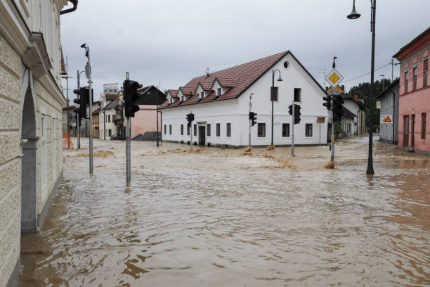
The condition of the local infrastructure will determine how fast the water drains or pools near the residential or commercial property. Old infrastructure in the city’s drainage system, blockages in the culverts, and construction near the area can change the water flow rate when there is an intense rainfall event in the area. The local environment and flood exposure assessment helps analyse how the stormwater drainage system will work, whether the property is near the canal, and the amount of pavement in the neighborhood.
How Digital Modeling Refines Insurance Quotes and Coverage Limits?
Selecting insurance policies demands accurate data in order not to overpay for extra insurance or be left without certain coverage in case of flooding.
-
No Generalizations by Regions
Generalizations based on the federal zone classification usually lead to underinsurance in the event of local floods in non-designated hazardous areas. Modeling allows the elimination of generalizations and the provision of accurate data about the parcel.
-
Structure Analysis and Foundation Consideration
Modeling takes into account such specific features of a house structure as the level of the slab, the size of the crawl space, and the kind of foundation used in the construction.
-
Address-Specific Risk Estimation
The use of digital flood risk mapping allows estimating the risk of flooding with absolute accuracy. The analysis of physical land contours and drain capacities will allow homeowners to avoid overpaying or being left unprotected.
-
Accurate Calculation of Insurance Costs
With the help of customized data, homeowners can get an accurate FEMA flood insurance quote.
Wondering how local climate analytics impact your true flood exposure?
Final Thoughts: What Are the Financial Risks of Using Federal Maps?
Relying on the accuracy of federal maps can leave property owners exposed to serious financial harm in case of unanticipated weather phenomena. Homeowners only discover later that the normal boundaries of the government are incapable of accounting for the internal rainfall that could occur within. Proper financial security requires moving beyond the usual government boundaries for flood risk assessment in Florida. At Flood Insurance HQ, our professionals are dedicated to providing assistance in order for our clients to choose between private and government insurance coverage.
Frequently Asked Questions
-
How does a modern flood risk assessment differ from traditional federal mapping?
Modern flood risk assessment takes into account high-resolution topographic information, localized hydrological modeling, and predictive climatic analysis to assess precise exposure of a property. This modern method differs from old-fashioned federal maps that broadly classify neighborhoods because the new method identifies specific changes in the terrain and the strength of the foundation at a specific address in Florida.
-
What factors are included in a flood exposure assessment?
The evaluation assesses the capability of stormwater management within the locality, the closeness to canals, and the density of pavement around the property. It evaluates the effect of local drainage systems and urbanization on water flow during periods of heavy rain. Thus, flood exposure assessment is an important element in determining the real risk of floods.
-
Why is a flood hazard assessment necessary outside high-risk zones?
Many severe weather events cause localized water accumulation and torrential downpours in areas not marked as high-risk on legacy maps. Evaluating these locations reveals hidden vulnerabilities that standard federal boundaries overlook entirely. Performing a flood hazard assessment ensures proper coverage before unexpected storms hit.
-
How does advanced flood mapping impact property protection decisions?
Geospatial technologies provide highly accurate information about the exact elevations and contours of the earth’s surface that impact the path of rainwater flow. This advanced flood mapping data helps in comprehending the real threat posed by water and allows choosing coverage amounts suitable for particular buildings.
-
Can digital flood risk mapping lower your FEMA flood insurance quote?
Flood risk assessment using advanced digital flood risk mapping gives insurers specific information about the elevation and structures, hence no need for generalized risk assumptions. With this precise information, the policyholder can obtain proper pricing of their flood insurance quote without being burdened by high-risk surcharges that are not applicable to them.


